
The
Etape Caledonia, (the 2013 edition of which takes place on the 12th of May), was the UK's first closed road cycling sportive. The event, part of the Highland-Perthshire Cycling Festival, has proved a roaring success and introduced the region to cyclists from across the UK.
My personal Perthshire discovery
came by way of seeking a ride to interrupt the car journey from
Edinburgh, up the A9 and into the Highlands. What
I discovered, and what thousands of others can already attest to, is
some of the best cycling you’ll find anywhere in the world.
My
ride mimicked - but reversed - much of the Etape's middle section,
looping out and around Loch Rannoch. However, instead of Pitlochry,
my mini-adventure started and finished in the small market town of
Aberfeldy.
I
parked up on Taybridge Drive, by the banks of the River Tay and
beneath the shadow of an imposing
memorial to the historic Black
Watch regiment. (The parking there is free and the adjacent putting
green’s public toilet is open March to October.)
 |
| Black Watch Memorial |
All
wrapped up against the elements (the dashboard thermometer read
1-degree C) I headed over General Wade's bridge, built in 1733 and
still going strong. The hump-back hurled me down and onto the B846,
which swept left through the village of Weem and on passed the 16th
century Castle Menzies. There are coffee, cakes and sarnies on sale
at the adjacent House of Menzies but it was a little too early in my
ride for a pit stop.
For
first five miles, the road was mostly flat, an opportunity to spin
the pedals and get some blood flowing to my icy-numb extremities. If
there had been any doubt as to the route's arduous prospect then a
look up ahead proved conclusive. The mountains reared imperious, the
road pointed ominously toward them.
 |
| Far From Dull |
I
rolled passed the village of Dull (twinned with Boring, in Oregon)
and through the poetically named Coshieville-- the point on this ride
where, if you don’t like climbs, semi-deserted roads and
jaw-dropping views, you should turn around and head for home.
The
climb commenced with twists and turns through dense woodland. I heard
the splashing water of nearby falls and was minded of past Pyrenean
forays. Although a decent test, I was only in fifth gear on a compact
chainset, spinning nicely, holding energy in reserve for the 50-odd
miles to come.
When
the road rose above the tree line, the mountains were back in view,
and seemingly bigger than ever. I shifted to reminiscing about
Italian Dolomites: the tarmac tilted steeply skyward like a mini
Marmolada, in my face and taunting.
Those
initial ascents were eased by the knowledge that my chosen route
would, eventually, come back down the same way, an extremely fast
descent as the gain from all that pain.
The
left turn along Schiehallion Road signaled the end of the climb and
came as a blessing to tired and
tightening legs.
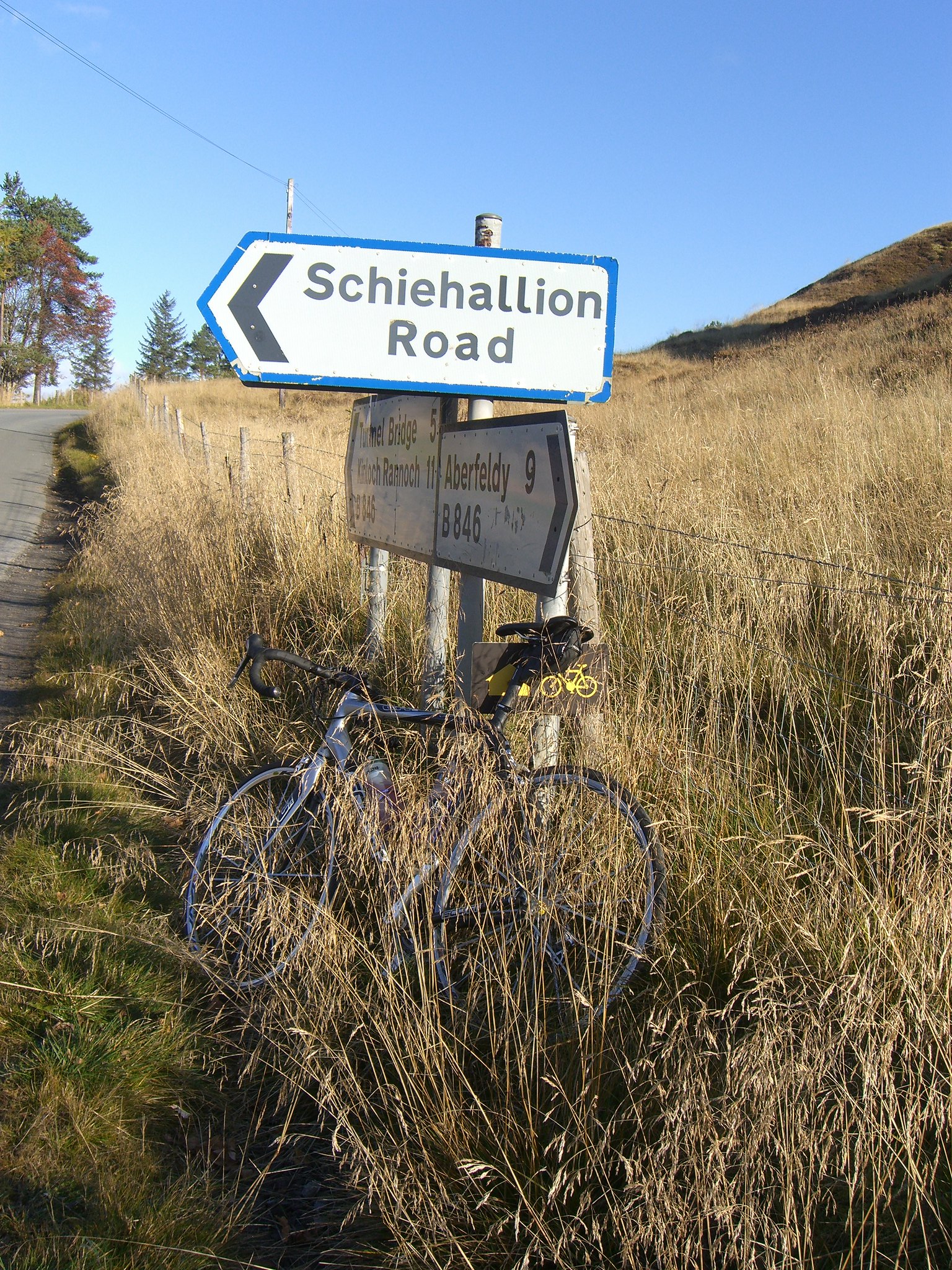 |
| Schiehallion Road |
That
single-track-saviour is so-named because it skirts the base of the
mountain, Schiehallion. A Munro at 3,547 feet, it's extremely
popular with walkers. It’s also the site of Charles Mason’s
pioneering 1774 experiment that attempted to estimate the mass of the
Earth. The result: heavy, man.
Whilst
there were mountains on my left-hand side, on my right there was open
space, soon to be filled with water--little Loch Kinardochy as
prelude to the larger Dunalastair Reservoir and then mighty Loch
Rannoch itself.
 |
| Car-Free Roads |
From
there the road’s profile formed a gentle, undulating wave. The
hardest part was stopping myself from constantly stopping to gawp at
the view, and to be aware of oncoming traffic--a too close encounter
with a road-hogging refuse lorry nearly turned me to trash.
By
Inverhadden, at about the 17-mile mark, I crossed the burn and kept
left. (A right-turn there leads to Kinloch Rannoch, ideal for a pit
stop or for reducing the route to a 40-miler - don't, you'll miss the
best of the scenery.)
The
unmarked road further narrowed, Loch Rannoch opened up on the right
and I was back to being distracted. The huge swathe of water
sparkled azure, exotic against the mountains' brown, green and
autumn-russet backdrop.
In
the big ring, I cruised by houses with big glass frontages that
allowed their residents to greedily grab the view. I dreamily
imagined waking up to that scenery and turned evergreen with envy.
By
Finnart, I was nearing the westerly end of the Loch and my ride's
mid-point, the hydro power station directly across the water, its
massive pipes running down the mountain to harness nature’s power.
My own energy had ebbed, so I made sure to eat and drink, filling up
for the return leg round the other side of the water.
 |
| Arty View |
That
turn came just after Bridge of Gaur with a right to rejoin the B846.
The left-hand fork leads to Rannoch Station where, as the sign
warned, the road ends (as does the rail line connecting to Fort
William, Glasgow and beyond). From that point on there’s nothing
but vast uninterrupted swathes of truly unspoiled wilderness.
Back
on the road and it was more of the softly undulating stuff I’d
enjoyed on the opposite shore. Again the views were amazing, perhaps
even better. I could now clearly see the mountains, and Schiehallion
in
particular. Sometimes referred to as the centre of Scotland, I
had a definite sense that my ride was revolving around its giant,
conical peak.
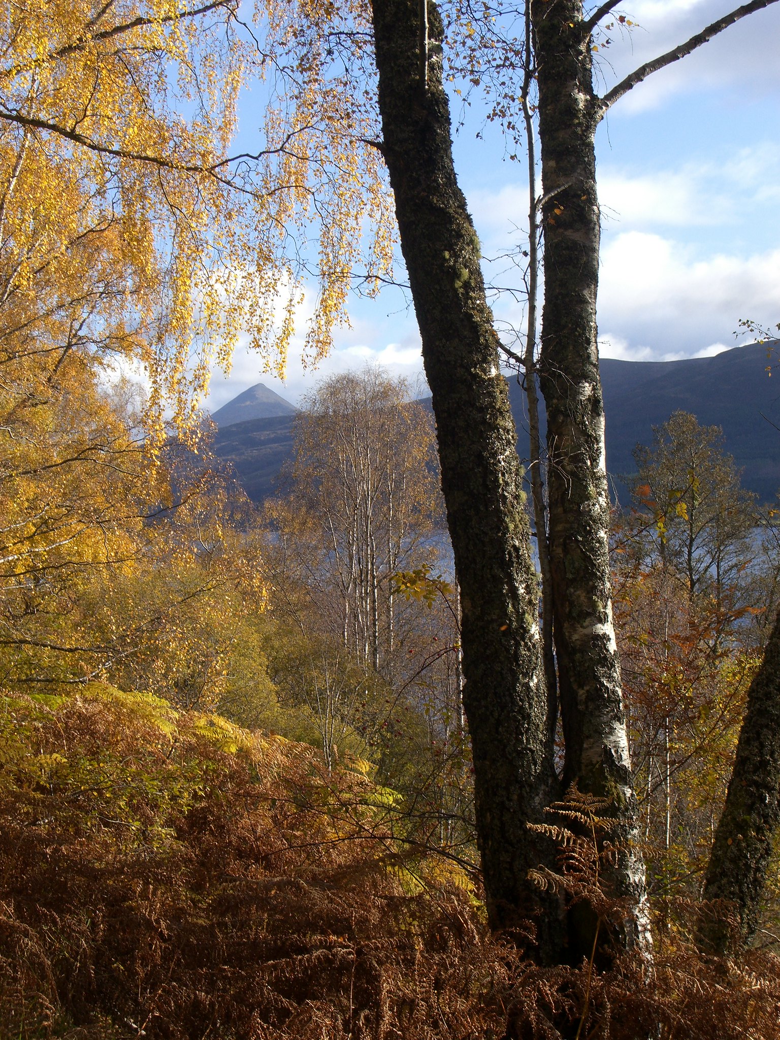 |
| Schiehallion in the Distance |
The
peace was also a joy to behold, especially for a city type like me,
my ride sound-tracked by little more than the wind on water, the hum
of tyres on tarmac, bird calls and the bucolic clucking of hens.
 |
| Kinloch Rannoch |
After
40 miles I’d reached Kinloch Rannoch. The village offered a couple
of options for food and caffeine refuelling but I was keen to follow
the signpost, keep on the B846 and head for Aberfeldy. I could smell
snow on the air, see the skies darkening and feel that the
temperature had further dropped.
The
road was still undulating but each consecutive rise seemed to be
longer and steeper than the one before. I clicked down through the
gears, back to munching energy bars as the road climbed some more
before rolling down and into Tummel Bridge.
I
remained on the B846 (navigationally, this route is a doddle) rolled
over the old bridge (another of General Wade's crossings), too weary
for sightseeing. By then the snow I’d smelled had started to fall,
no more than flurries but sufficient to keep thoughts on the flask of
coffee in the car at Aberfeldy.
Whereas
that initial climb out of Coshieville was probably the second hardest
part of this route, the first was now definitely upon me, and no mere
undulations.
The
next rise hurt but I got over it okay. Then came another. It hurt
more and I fared less well, the accumulated fatigue taking additional
toll. The road surface - one of those heavy, Scottish energy-sapping
sorts - didn’t help matters. By the next rise I was out the saddle
and almost at a standstill.
My
eyes, dragged from the view, were now locked to the odometer's
digital display, dizzy brain wondering why all my effort failed to
add digits to the tally.
Eventually,
the last rise was crested. I swigged from the dregs in my bidon and
flew downhill, passed that
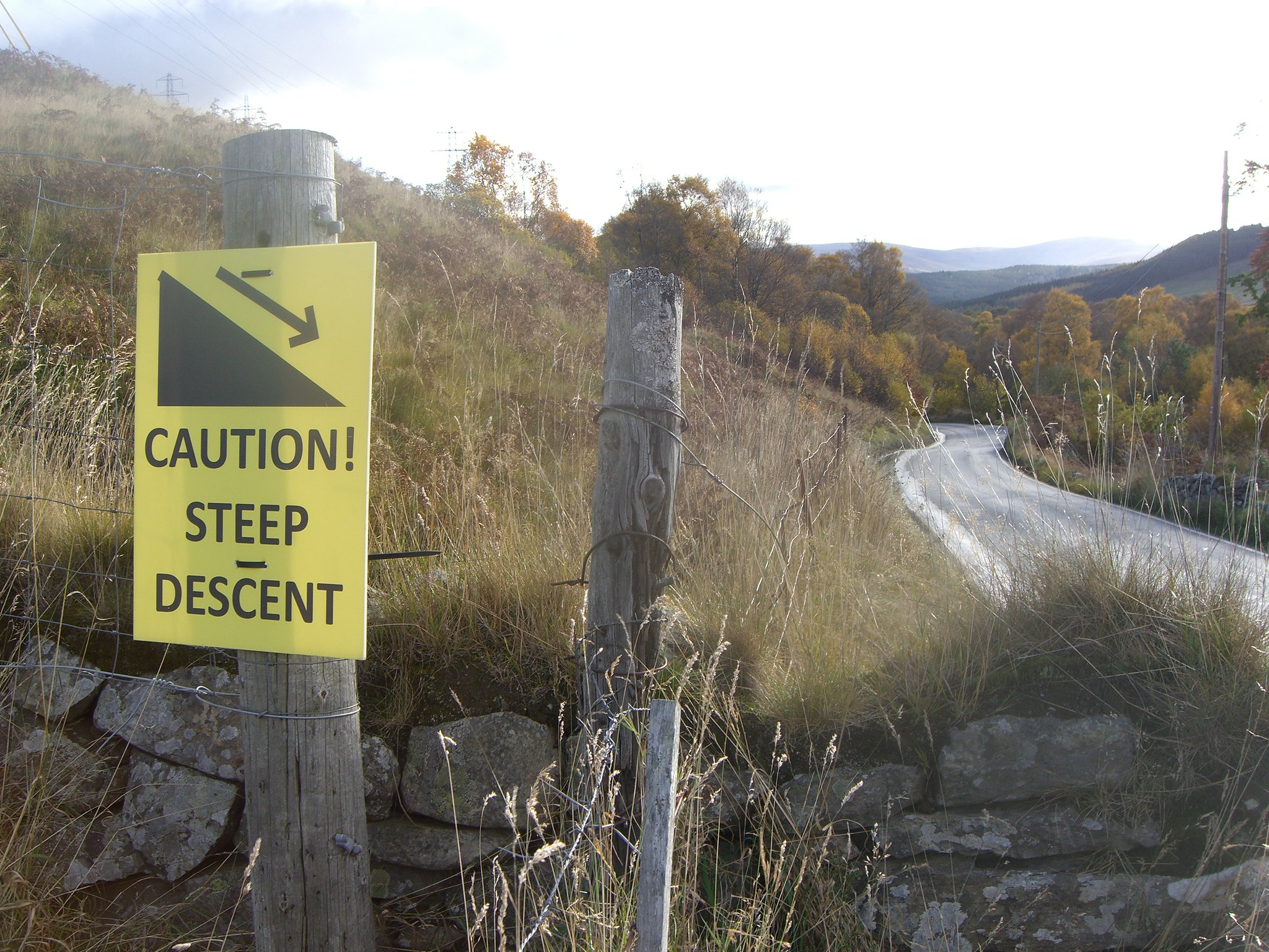 |
| Steep Equals Fast Equals Good |
turn to Schiehallion Road, for a descent
truly earned and thoroughly enjoyed.
I
swept round the bends, out through Coshieville and landed back on the
road to Aberfeldy. A few miles in which to warm down, a last heave
over the hump in Wade’s old bridge, and I was back at the car with
my coffee.
No comments:
Post a Comment